Winter takes a holiday; high hits 70

TONY BROWN/DAILY FORUM
Molly Simmerman, 2, was feeling the wind in her hair Thursday afternoon while playing on one of the slides at Beal Park. Temperatures in the low 70s in the middle of February convinced many local residents that it was time to head outdoors for an early taste of spring.
It hasn’t exactly been beach shorts and sandals weather this week, but, with temperatures reaching into the low 70s, Thursday was easily one of the warmest February afternoons Nodaway Countians have enjoyed in years.
Jeff Bradley, a senior instructor of geology at Northwest Missouri State University who teaches meteorology courses, said yesterday’s high was probably short of a record. However, one has to go back a ways to find anything comparable.
According to the University of Missouri Extension Historical Agricultural Weather Database, the last time it was this warm at this time of year in northwest Missouri was in 2011, when the temperature hit 71 on February 17 and 68 on Feb. 20.
Other February warm spells occurred in 2006, when the high was 68 on Feb. 27, and in 2000, when the thermometer reached 68 on Feb. 24 then 70 four days later.
Last year on Feb. 18 the thermometer recorded a balmy 16 degrees above zero.
“Normal for this time of year is about 40 for a high with lows around 20,” Bradley said. “So we’re close to a record. I think they were calling for a possible record around the Kansas City area.”
While this week’s warming trend is exceptional, it comes toward the end of a winter during which slightly above-normal temperatures have been the rule rather than the exception. Total snowfall is also well below average.
Bradley said that fits the pattern for an “El Niño” winter during which a combination of atmospheric conditions over North America and unusually warm ocean temperatures off the coast of South America combine to ease the season’s usual icy grip on the Midwest.
The result, he said, has been a sort of reversal of the “polar vortex” effect that last winter pulled seemingly endless blankets of cold air across northern Missouri from Canada and sent temperatures sinking into the low double-digits before Thanksgiving.
This winter, by way of contrast, blankets of warm air have been pushed across the nation’s midsection from the Pacific with the help of a jet stream that has drifted well to the north and a series of strong high-pressure systems that typically produce drier air and clearer skies.
The position of the jet stream, or “storm track,” Bradley said, has proved crucial, since everything north of this powerful, persistent river of air lies unprotected from the Canadian cold.
In essence, the jet stream acts as a sort of wall against frigid weather that allows warmer El Niño conditions to spread out over much of the United States, including — at least his year — Nodaway County.
Maryville, Bradley said, is situated virtually on top of the “storm track” dividing line, so the warm-cold divide can go either way.
A couple of weeks ago, for example, forecasters were calling for up to 12 inches of snow here, but the expected descent of the jet stream failed to occur, and the white stuff fell elsewhere.
“Everything shifted, and we got no snow,” said Bradley, noting that areas to one side or the other of the storm track can experience temperature differentials of 40 degrees or so.
“This time of year the jet stream is hovering over the middle of the U.S.,” Bradley said, “and right now it’s well north of us.”
Other conditions contributing to warmer weather this winter, he said, include a relatively small snowpack in the Rocky Mountains, meaning that warm Pacific air hasn’t cooled off as much as it might have on its way over the Continental Divide and across the Great Plains.
“That’s a contributing factor that buys you a few degrees,” Bradley said.
But don’t get out the suntan lotion just yet. Punxsutawney Phil may not have seen his shadow, but Old Man Winter in Missouri has never been noted for paying much attention to groundhogs.
According to Bradley, the three-month weather outlook calls for only slightly warmer-than-normal temperatures through March along with average precipitation. That means heavy snowfall is still very much a possibility.
“We actually can get some of our heaviest snows in March,” Bradley said. “The atmosphere starts to warm up, which means it can hold more water.”
The result, he said, can be wet, heavy snow as opposed to the blowing, drifting powder common in December and January.
As for any tie between the current warm spell and climate change or global warming, Bradley said there’s no way to make that kind of connection based on a single winter.
“Next year you may be calling to ask me ‘What’s with this cold snap?’ and it wouldn’t surprise me in the least,” he said.
However, Bradley added that most models indicate “a gentle warming trend” for most of the last century.
“You look at glaciers retreating and the spread of tropical diseases into the middle latitudes — that’s pretty good evidence that climate seems to be on a warming trend,” he said.
After Thursday’s near-record, look for slightly cooler temperatures in the mid-60s today and Saturday with highs dropping into the low 50s on Sunday.
The cooling trend will likely continue through the first of the week, with highs in the mid-40s and lows in the high 20s.

TONY BROWN/DAILY FORUM
Emma Simmerman, 4, navigates a small climbing wall built into a playscape at Beal Park. Emma was at the park Thursday afternoon with her younger sister Molly and mother, Julie, taking advantage of a rare warm day in February. Though spring hasn’t sprung yet, the unseasonably warm weather is expected to linger with highs in the mid-60s Saturday and low 50s on Sunday.
TONY BROWN/DAILY FORUM
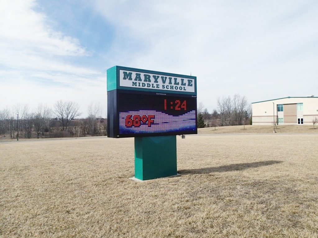
At 1:24 p.m. Thursday it was 68 degrees according to the digital sign in front of Maryville Middle School, and an eventual high of 72 definitely brought a welcome preview of spring to a winter-weary Nodaway County. The warm spell is expected to linger through much of the weekend with more seasonable temperatures returning on Monday.