What winter? Mild temps draw February’s sting
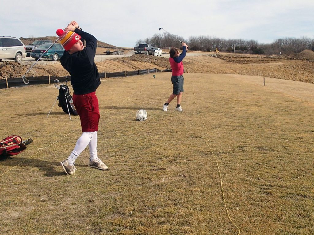
TONY BROWN/DAILY FORUM
Joey Scott, left, and Joshua Jones, both members of the Northwest Missouri State University Bearcats baseball team, took some time out over the noon hour Thursday to hit a few balls at the Sechrest 18 driving range at Mozingo Lake Recreation Park. Unseasonably warm weather has moved into the Maryville area, with mild conditions and highs in the 60s expected to continue through the weekend.
It’s probably a little early to break out the Bermuda shorts, straw hats, and sandals, but mid-February in northwest Missouri — often the time of year when winter is at its bleakest — is offering Nodaway Countians a welcome glimpse of spring.
After relatively warm, sunny weather moved into the area Wednesday afternoon, even milder conditions were forecast through the rest of this week, with today’s predicted high in the 70s.
According to the National Weather Service, things will cool off a bit Saturday and Sunday, with highs in the mid-60s before perhaps touching 70 again on Monday, when there is a possibility of rain.
The predictions suggest highs that are 20 degrees or more above normal for this time of year.
According to Senior Instructor Jeff Bradley, who teaches climatology and meteorology courses for Northwest Missouri State University’s Department of Natural Sciences, a typical day during the second or third week in February usually brings high temperatures in the low 40s.
If, that is, it’s not 15 degrees above zero with two feet of snow on the ground.
“I’m teaching a climatology class right now,” Bradley said, “and I tell my students that in our part of the country when it comes to ‘normal,’ you have to put air quotes around that thing.”
Meaning that north Missouri’s 40-degree average for mid-February simply shows that it can easily be 20 degrees one day and 60 the next.
But 70 and above? Even in the changeable Midwest, that’s a little weird.
“I wish I had a good answer for you,” Bradley said. “All I can say is that the storm track has been well to our north. Normally it’s right in our neighborhood.”
The main storm track across North America, Bradley said, generally hovers around the jet stream, which often drops south into central Midwest this time of year.
The effect, if it persists, can become what weather experts call a “polar vortex,” which amounts to an open gate that allows a stampede of frigid air to barrel down from Canada.
While that gate was at times unlocked earlier this winter, causing brief cold snaps in mid-December and early January — as well as a massive ice storm a month ago that hammered the Great Plains and grazed Nodaway County — it has since remained firmly shut.
Of course, things can still change, but Bradley said the computer models he’s looking at indicate the storm track is likely to remain to the North for at least the next couple of weeks.
If that happens, he said, conditions should — underline the word “should” — produce temperatures “at least somewhat above normal” into the early part of March.
So is winter over? Don’t bet on it.
“I don’t want to jinx us,” Bradley said. “Sometimes we get snow as late as May. Personally I would love it (if it stays mild), but it’s awfully early. If the jet stream shifts, we could still get some heavy, wet snows in March.”
Still, the signs are hopeful.
“We’re getting a lot of Pacific air,” Bradley said. “Without that cold air coming in from Canada we’re going to stay pretty mild for a while.”
All of this flies in the face of predictions made earlier this year that called for cold, wet winter across the Midwest thanks to a phenomenon called La Nina.
Back during the first week of December, when the season’s first sub-freezing cold snap swept across the region, Tony Lupo, a University of Missouri professor of atmospheric science, predicted that snow shovels would get a lot of use during a winter when many thought temperatures would fall — and remain — below average.
“I’m thinking it’s going to be a little colder than normal,” Lupo said. “This is due to the neutral-to-weak La Nina conditions that are in the Pacific.”
During a La Nina cycle, sea surface temperatures across the equatorial eastern central Pacific Ocean are lower than normal, a circumstance that can force the jet stream to drop down and cut through the central United States and upper East Coast. The result is often weeks of snow, ice, cold, and misery.
While weak La Nina conditions did develop this year, climatologists say the cycle is already dissipating, and that various computer models now show an upward trend in sea surface temperatures.
“La Nina hasn’t really been a factor for us here in the Midwest,” Bradley said.
If predictions for continued mild weather across the region over the next two weeks pan out, the National Weather Service office in Pleasant Hill reports, 2017 will go down as the first snowless February in the Kansas City area since 1892, and only the second such winter since record-keeping began.
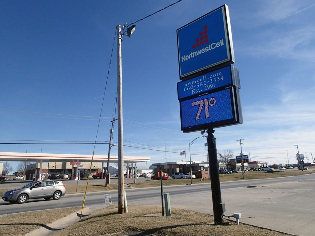
TONY BROWN/DAILY FORUM
According to one thermometer at least, Thursday’s high temperature edged into the 70s during a picture-perfect day in Maryville that, for a few delicious afternoon hours, felt more like April than the middle of February.