Maryville warming centers open doors, temperatures to drop
NATIONAL WEATHER SERVICE
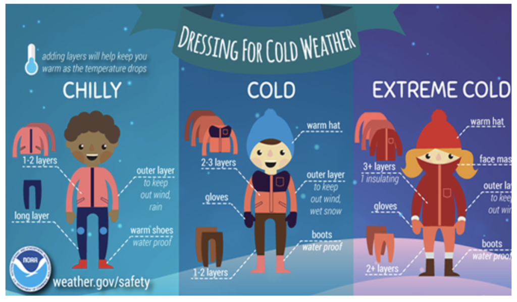
Dressing for Cold Weather
MARYVILLE, Mo. — Nodaway County Emergency Management Director Christy Forney has announced three locations that will serve as warming stations during the upcoming winter weather event.
The United Methodist Church, Maryville Public Library and Maryville Community Center will offer different hours throughout the next week. They are listed below.
According to an email from Stephanie Patterson, director of the Maryville Public Library, their building will be closed Friday, Jan. 12 to allow crews to clear streets, but hopes to reopen Saturday from 9 a.m .to 3 p.m. and be open to accommodate those in need of a warm place.
According to an email from Forney, the National Weather Service has placed Nodaway County in a Winter Weather Warning starting from 7 p.m. Thursday, Jan. 11 through 9 p.m. Friday, Jan. 12.
The service is forecasting 4 to 8 inches of snow accumulation and wind gusts up to 40 miles per hour.
“This will make travel extremely dangerous,” Forney noted in the email. “This snowstorm will be followed by extremely cold temperatures over the next few days. … Those using a warming station are asked to please be respectful of the space, as other activities may be going on.”
_____________
- United Methodist Church
- 102 North Main Street/Maryville
- Sunday, Jan. 14: 7:30 a.m. – 1 p.m.
- Monday, Jan. 15: 8:30 a.m – 7 p.m
- Tuesday, Jan. 16: 8:30 a.m – 7 p.m
- Wednesday, Jan: 17, 8:30 a.m – 8 p.m. (free meal served 5:15 to 6 p.m.)
- Thursday, Jan. 18: 8:30 a.m – 7p.m
- Maryville Public Library
- 509 North Main Street/Maryville
- Closed Friday, Jan. 12
- Monday through Friday: 9 a.m. – 6 p.m.
- Saturday: 9 a.m. – 3 p.m.
- Closed Monday Jan. 15.
- Maryville Community Center
- 1408 North Country Club Road
- Monday through Friday: 5 a.m. – 9 p.m.
- Saturday: 6 a.m. – 5 p.m.
- Sunday: Noon – 5 p.m.
_____________
Forney sent along information from the NWS regarding snow accumulation and cold weather safety tips.
Snow Today. Brutal Cold Arrives Tonight.
Bitterly cold temperatures continue this weekend into early next week
Snow continues today, primarily for locations north of the Missouri River
- Highest accumulations over far northern MO near the Iowa border
- Wind gusts up to 40 mph could lead to blowing snow and low visibility over far northern MO
- Very minor ice accumulations possible this morning
Dangerously cold temperatures expected tonight into next week.
- Wind Chill Warning in effect region-wide from 6 pm tonight through 12 pm Tuesday
- Well below zero low temperatures Saturday night, Sunday night and Monday night
- Wind chills 15 to 35 below zero Saturday night, Sunday night and Monday night
_____________
Cold Weather Safety
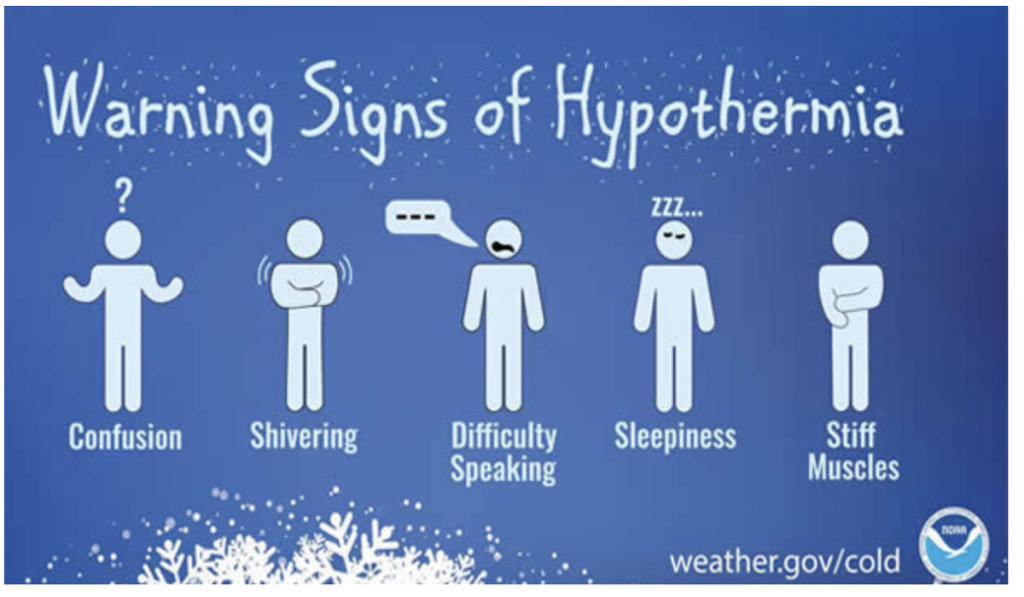
Extremely cold air comes every winter into at least part of the country and affects millions of people across the United States. The arctic air can be dangerous. Combined with brisk winds, dangerously cold wind chill values can result. People exposed to extreme cold are susceptible to frostbite and can succumb to hypothermia in a matter of minutes. Areas most prone to frostbite are uncovered skin and the extremities, such as hands and feet. Hypothermia occurs when the body loses heat faster than it can produce it.
Cold weather can also affect crops. In late spring or early fall, cold air outbreaks can damage or kill produce for farmers, as well as residential plants and flowers. A freeze occurs when the temperature drops below 32°F. Freezes and their effects are significant during the growing season. Frost develops on clear, calm nights and can occur when the air temperature is in the mid-30s. Each plant species has a different tolerance to cold temperatures. You may also want to check out our winter safety site for snow and more cold season hazards information.
If you or someone you know has been a victim of extreme cold, please share your story so we can help prevent others from becoming a victim. When you write, please state that the NWS has permission to use your story, and let us know the town and state you were in and when the event took place. Read our real-life stories from extreme cold survivors.
Closings and Cancellations
To view a regularly updated list of closings and cancellations click HERE.
Gov. Parson puts Missouri National Guard on standby
JEFFERSON CITY, Mo — Gov. Mike Parson signed an executive order in preparation for forecasted severe winter weather late Thursday afternoon.
According to a news release from Parson’s office, he signed Executive order 24-02 as a precautionary measure to prepare for winter weather, especially extreme cold temperatures expected to impact the state of Missouri starting this weekend.
The order waives certain hours of service requirements for commercial vehicles transporting residential heating fuel and activates the Missouri National Guard for state and local response efforts, if needed.
“With extreme cold forecasted for this weekend, we want to be prepared to respond however may be needed,” Parson said in a statement. “Missourians should be proactive in their preparations and so too should state government.”
The order will expire Jan. 26, unless otherwise extended noted the release.
NATIONAL WEATHER SERVICE
Warning signs of hypothermia