Winter arrives as Nodaway dodges worst of wild weather
TONY BROWN/DAILY FORUM
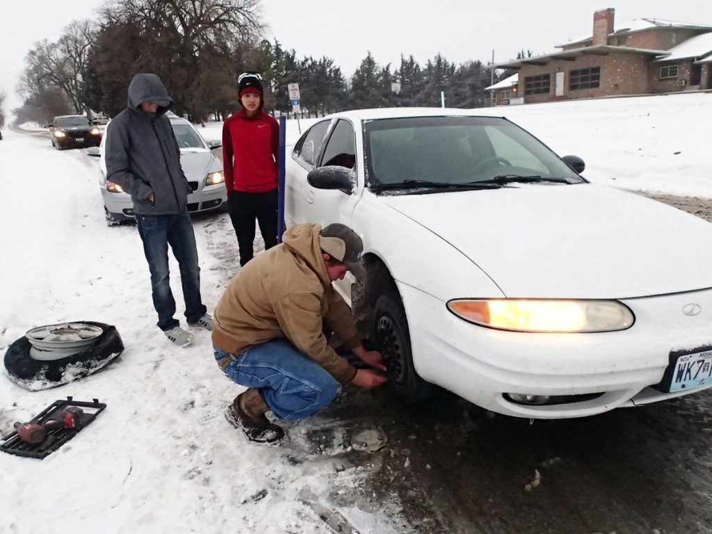
Brandon Auffert, foreground, who works for the local MFA co-op, used a battery-operated drill to change a stubborn flat tire Monday morning for Maryville High School students Chance Hermelink, left, and Frank Ancona at the corner of North Depot and East Third streets. While the first major snow event of the season wasn’t the best time to have a flat, city crews were able to clear key thoroughfares by daybreak, allowing traffic, which was light, to keep moving without major problems.
While the weather has definitely take a turn for the worse in Nodaway County, things could have been a lot more serious.
The first major winter storm of the season swept through northwest Missouri Sunday night and into Monday morning, leaving behind 3 to 6 inches of snow. More snow was possible Monday night and perhaps through mid-week.
However, the National Weather Service reported that the storm was to bring relatively minor accumulations of ice and freezing rain across NWS’ Zone 3, which includes Nodaway County.
This was in contrast to the central and southern portions of the state, where there were reports of ice, and heavy rains caused widespread flooding resulting in at least eight fatalities, according to the Associated Press.
Over the weekend, six people died when two separate vehicles drove into flooded roadways in south-central Missouri, according to Pulaski County Sheriff Ronald Long. Four of the victims were international soldiers temporarily stationed at Fort Leonard Wood.
The remaining fatalities included 42-year-old Steven Welton, who drowned in a Greene County creek Saturday when his vehicle was washed off the road. His body was recovered Sunday.
Also killed in the Springfield area was 60-year-old Edward Kammerer, a tow truck driver who was attempting to retrieve a vehicle that had gone off the roadway when he was electrocuted by a downed power line.
County Emergency Management Executive Director Chet Hunter said that between midnight Saturday and early Sunday afternoon there were 104 water rescues in Greene County alone.
According to the Missouri Department of Transportation, nearly 200 roads were closed statewide Monday due to high water.
In Nodaway County, by contrast, no serious accidents were reported, though Maryville police did respond to a minor collision early Monday afternoon at First and Main.
With schools still out on Christmas break, including Northwest Missouri State University, traffic was light, and many residents opted to travel no further than walking the distance it took to shovel sidewalks and snow-blow driveways.
The Nodaway County Sheriff’s Department reported no major accidents as of press time Monday, and the City of Maryville did not invoke its emergency winter storm ordinance, which bars parking along designated routes following heavy snowfall.
“So far so good,” said Maryville Public Safety’s Christy Forney, who also serves as the county’s Emergency Management Director. “We’ve been quiet here at Public Safety.”
In other words, the Maryville area seemed to be taking winter in stride.
This week’s storm is hardly a record breaker for late December, and Forney said advances in forecasting technology and inter-agency communication have helped take some of the dangerous edge off snowy weather.
“MoDOT (the Missouri Department of Transportation) is really good about taking care of what they need to take care of,” she said, “And law enforcement is prepared for the traffic issues.”
As storm forecasts intensified going into the weekend, Forney said she consulted with regional shelter director Leslie Riney of the state Department of Social Services’ Family Support Division. She said the two discussed worst-case scenarios, such as a widespread power outage, that might force people to leave their homes.
A number of shelter options exist in Maryville, Forney said, but the first choice is Maryville Middle School because it shares a high-priority power grid with St. Francis Hospital.
While the storm failed to cause major problems locally, the long warm spell enjoyed by Maryville-area residents is apparently over. Look for highs falling into the 20s and teens for the rest of the week with a forecast low of 8 degrees above zero Thursday night.
On other fronts, Gov. Jay Nixon on Sunday declared a state of emergency for much of Missouri in the wake of heavy rains and flooding.
More rainfall was anticipated across central Missouri and the Ozarks through Monday with river levels expected to rise for the next several days.
A release issued by Nixon’s office said the Missouri State Highway Patrol had conducted dozens of water rescues while assisting with evacuations in the flood zone.
“Widespread flooding and continued rainfall are causing very dangerous conditions across much of central and southern Missouri,” Nixon said in a prepared statement. “Multiple fatalities due to flash flooding have already been reported, and I urge Missourians in flood-affected areas to stay alert.”
The Associated Press contributed to this report.
TONY BROWN/DAILY FORUM
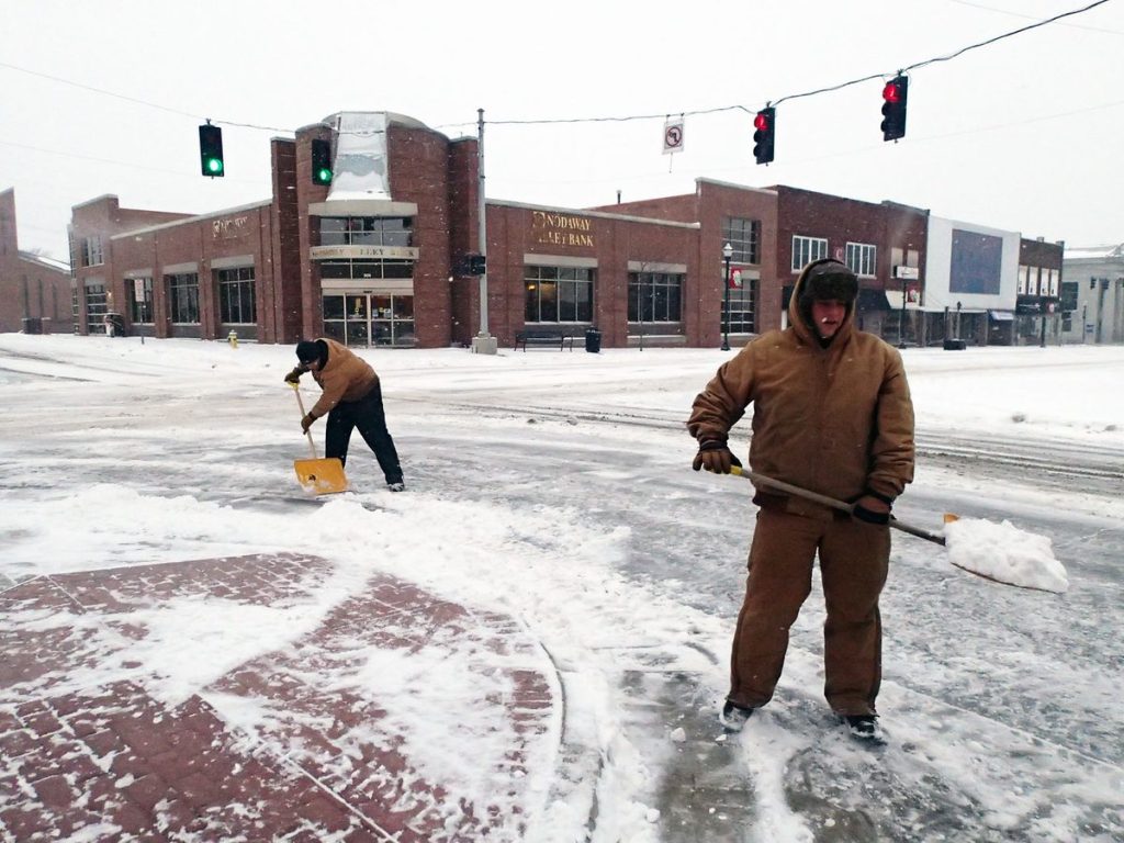
Sam Doolin, left, and Alex Bruckner, of Maryville Parks & Recreation, helped city and county workers clear public sidewalks and parking lots around the courthouse square Monday morning after the first significant snow fall of the year.
TONY BROWN/DAILY FORUM
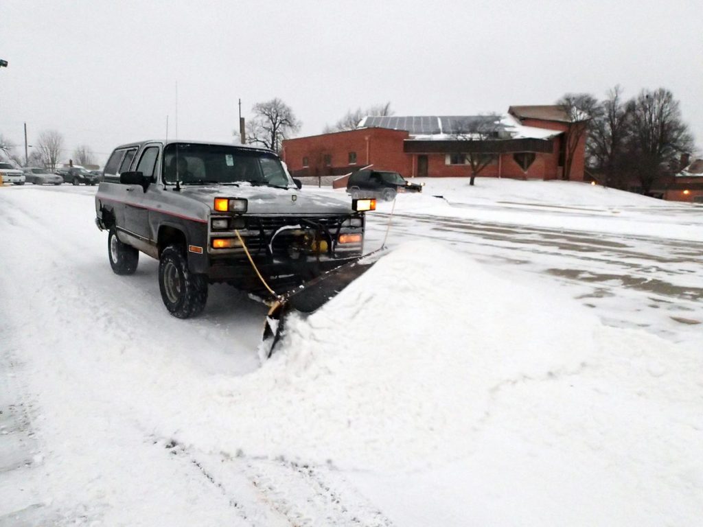
A pair of plow-equipped SUVs made short work of clearing snow from the St. Gregory Barbarigo Catholic Church parking lot Monday morning. While the opening storm of the season could have been much worse compared to wild weather across much of the rest of the state, north Missouri’s extended warm spell is apparently over. Look for highs falling into the 20s and teens for the rest of the week with a possible low of only 8 degrees above zero Thursday night.