Tornado sighted southwest of Skidmore
SUBMITTED BY SHAWNA DAVIS
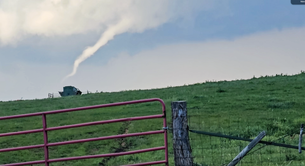
Shawna Davis submitted a video, from which this screenshot was taken, of a funnel cloud forming on Friday, April 26, three miles east of Barnard and north of State Route M.
MARYVILLE, Mo. — Tornado sirens went off two days in a row in Maryville last week and a tornado touched down near Skidmore as the latest round of severe weather blew through the region.
On Friday, a tornado briefly touched down about two miles southwest of Skidmore, following the Nodaway River and ripping into an open farm field before ascending, according to a report collected by the National Weather Service and Nodaway County Emergency Management Director Christy Forney.
TORNADO SIREN FAQ
When are sirens activated?
Only in two situations: Either when a tornado warning has been issued by the National Weather Service because of a radar-indicated tornado, or when a trained storm spotter has otherwise confirmed a funnel. If sirens are activated, the area is in the path of a tornado. Should I be able to hear the sirens inside my home?
The warning sirens are intended for people who are outside to let them know they should seek shelter indoors immediately. People already indoors should use other methods to track severe weather that can provide more information like TV, radio, weather apps, NOAA weather radios or by using the city and county’s Textcaster alert system. The sirens stopped. Does that mean it’s safe to leave cover?
No. The sirens are activated when a tornado is immediately threatening an area, but they do not continue for the entirety of the event. Keep track of storm updates through other means like TV, radio or weather apps. The sirens went off once, then again later. Does that mean it’s all clear?
No. Sirens in Nodaway County will never give an all-clear signal. Instead, if sirens are activated multiple times, it means there are multiple severe weather events. Residents should take shelter again or stay in shelter if sirens go off again.
That was the only confirmed tornado in Nodaway County — and it may have predominantly been in Holt County — but several incidents of cloud rotation and funnel clouds were reported.
Friday evening, Forney said that trained storm spotters positioned at the western edge of Maryville reported a funnel cloud, though it did not touch down. The tornado warning even disrupted one of Northwest Missouri State University’s commencement ceremonies, forcing an evacuation into the basement of the Lamkin Activity Center.
Tornado sirens went off once at the beginning of the tornado warning, and went off again later “due to multiple reports in multiple locations,” Forney said in an email to The Forum. Tornado sirens are triggered any time there is a tornado warning for the area or when a storm spotter reports cloud rotation.
On Saturday, Forney said that again she received multiple reports of funnel clouds and rotation, but no tornadoes reported in the county.
“Fortunately, these storms could not get their act together,” Forney said. “It is rare that we see a line of severe thunderstorms like we did this weekend that affect the entire county. Everyone in the first responder community did an excellent job of dispatching resources and relaying information.”
Then again on Tuesday, another line of severe storms rolled through, producing baseball-sized hail in Nodaway County, according to reports collected by the weather service.
Thunderstorms are expected to come through the region again on Thursday, but are not expected to be as severe, according to the weather service.